Ohio Storm Surge: Wind, Snow & Tornado Drill Insights
Ohio faces a severe weather barrage—from 70+ MPH winds causing havoc to a rapid temperature drop, snow showers, and a statewide tornado drill, all detailed in this in-depth report.
Ohio’s Weather Under Siege
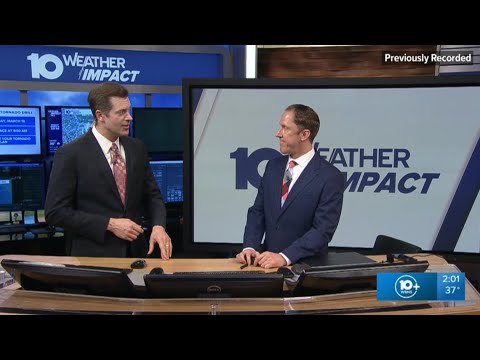
On March 16, 2026, WBNS 10TV’s meteorologists delivered an intense and comprehensive update on the extreme weather conditions impacting the state. In this special segment of the 10 WEATHER IMPACT Show, meteorologists Chris and Aaron White detailed a week marked by destructive winds, abrupt temperature drops, and a swift transition from rain to snow showers. The report not only provided live updates and forecasts but also offered practical advice for residents facing severe weather conditions.
Unprecedented Wind Gusts and Aftermath
The segment begins by highlighting the violent wind storm that rocked Ohio on Friday, with gusts exceeding 70 MPH. Chris explained, "We had those wicked winds across the state... a big gust, even reaching 85 miles per hour in Cleveland." Such extreme weather is rare for Ohio, especially on a day when the skies had been clear and sunny. The high winds resulted in power outages, overturned semis on I-71, and downed trees, creating hazardous travel conditions and leaving many residents scrambling for safety.
Aaron White recalled his personal experience, noting that areas were littered with fallen trees and debris. "I remember driving through our neighborhood and there were trees down, people out there cutting them up," he said. This dramatic event underscored the power of the storm and the lasting damage it inflicted. Local authorities advised residents to carefully document any property damage, suggesting that such evidence could be crucial for insurance claims and potential property tax relief adjustments.
A Rapid Temperature Drop and Shifting Forecast
In an unusual turn of events, the weather took another dramatic shift following the windy havoc. The temperature plummeted from a balmy 65 degrees at midnight to a chilly 37 degrees by early afternoon. Meteorologists on the show remarked on the staggering 40-degree drop in hours, explaining that the rapidly cooling temperatures set the stage for the imminent arrival of snow showers.
Aaron explained the evolving conditions: "We’re talking about snow showers now... from 77 degrees yesterday afternoon to 37 degrees today. The change has been really remarkable." This abrupt decline serves as a textbook example of how quickly weather can transition in transitional seasons, and it has significant implications for both travel and daily routines.
Tornado Drill and Severe Weather Awareness
In light of the recent severe weather outbreaks, Ohio is dedicating the week to raising awareness and preparedness for tornadoes. The segment provided advanced notice of a statewide tornado drill scheduled for Wednesday at 9:50 AM. Chris emphasized the importance of this drill: "This is a good time to practice your safety plan, whether that's at home with your family or at work with your coworkers." This statewide initiative is a proactive measure to ensure that residents remain alert and prepared in the face of potential tornado threats, especially as the spring season unfolds.
The meteorologists urged communities to avoid dangerous spots during severe weather events, even jokingly reminding viewers, "go hide under an underpass, right? That's the worst place to be." Such candid advice stresses that while drills are important, real-life scenarios require everyone to follow safe, proven practices.
Detailed Forecast and Radar Updates
The video segment transitioned smoothly into a detailed forecast for central and eastern Ohio. Using live radar imagery, the meteorologists described pockets of light snow showers, particularly across the eastern and southern counties. Areas like Zanesville, MacArthur, Jackson, and Athens might experience intermittent flurries as the cold air mingles with residual moisture.
Chris provided a comprehensive 7-day forecast:
- Today: Cloudy skies with sustained winds of 20-25 MPH and a chance of light snow or flurries, especially near Lincoln County.
- Tuesday (Saint Patrick’s Day): A dramatic cold front will move in, with temperatures at times dropping to subfreezing levels around 20 degrees.
- Wednesday: The potential for additional snow showers remains, though overall conditions should be relatively stable by the afternoon.
- Thursday & Friday: A significant warm-up is expected with temperatures rising to the low 60s on the first day of spring.
Aaron pointed out that despite the progressive spring conditions, winter is still holding on with enough force to deliver travel and safety challenges. He warned, "just a couple of snow shower chances over the next few days... it really is a hit or miss time for travel across the state." This mixed forecast has important implications for commuters and families planning outdoor activities.
Travel, Safety, and Community Preparedness
As residents began to clear debris and assess damage, local officials stressed the importance of safety and community action. In Columbus, the city’s Parks and Recreation Department announced that affected residents should report any downed trees by submitting details via 311 during business hours or contacting the non-emergency police line after hours. Furthermore, Franklin County’s Auditor’s office advised residents to document damage thoroughly with photos and repair estimates—a critical step in beginning insurance claims for wind-related destruction.
This practical guidance is a key element of the broadcast. The meteorologists reinforced the need for preparedness during severe weather, advising viewers to keep emergency kits ready and to stay informed via the free 10 TV app. "For all the latest weather alerts, just download the free 10 TV app on your phone and turn on the notifications," one meteorologist stated emphatically.
Blizzard Conditions Across the Midwest
The reach of the severe weather was not limited to Ohio. The report also covered extreme conditions in the Upper Midwest, where blizzard warnings have been issued. Radar images showed a heavy snow blizzard in areas as far north as northern Michigan and upstate Wisconsin. In the harsh winter conditions, some parts of Wisconsin reportedly received snowfall amounts exceeding 25 inches.
The segment contrasted these harsh winter conditions with regions that have long relied on heavy snow for winter sports. Meteorologists noted that ski resorts in northern Michigan and parts of Colorado are closely monitoring the situation. For example, ski resorts at Boyne Mountain in Michigan might see significant powder days as the storm system pushes a mix of snow to their slopes, although other areas in the Rockies are experiencing a notable snow drought.
Community Stories: Rescues and Resilience
The 10 WEATHER IMPACT Show didn’t just focus on weather data – it also brought forward compelling human interest stories. In parts of Texas, high winds led to multiple traffic accidents, with one dramatic clip showing cars crashing on Highway 287 amid swirling debris. Meteorologists commented on the widespread impact of these dangerous conditions, drawing connections between regional wind events. They noted that while the 70-80 MPH gusts in Ohio were particularly unusual, similar wind events have been observed in Montana and the Upper Midwest.
In another poignant story, crews in Hawaii faced the challenge of rescuing individuals trapped by heavy rains and rising floodwaters. Honolulu firefighters and emergency crews rescued stranded people under a bridge on Kapiolani Boulevard. One rescue even prioritized the safety of a dog before saving its owner—a clear demonstration of community compassion amid natural disaster. Lynn Kawano of Hawaii News Now highlighted that some of those rescued were already suffering from hypothermia, underscoring the perilous nature of the storm conditions.
The video also included lighter moments that captured the resilience and spirit of affected communities. In Minnesota, scenes of children and families enjoying the snow after the storm reminded viewers that even amid disruption and danger, there is hope and a chance to create joyful memories. Photojournalists captured families sledding down snowy hills and making snowmen beneath the towering silhouette of the Saint Paul Water Tower. One resident humorously wagered, "I think we're at 75 to 25 that we won't have school tomorrow," illustrating that even in the midst of severe storms, life finds a way to entertain and endure.
Economic Impacts and Travel Concerns
Beyond immediate physical hazards, the extreme weather has broader economic implications. In regions such as Colorado, where the ski industry is a major economic driver, reduced snowfall has led to a significant downturn in Canadian visitor numbers—a key demographic for winter tourism. Recent surveys reported a 40% drop in Canadian visitors, which has already affected the local economies of several ski towns. Meteorologists on the show drew attention to this issue, noting that reduced snowfall in some parts of the Rockies has put pressure on the $50 billion ski industry.
The report also touched on travel difficulties beyond just snowy roads. In Nashville, AT&T service remains disrupted in the aftermath of a severe winter storm that hit earlier in the year. For nearly two months, residents have dealt with intermittent connectivity issues, further complicating communications during a period already fraught with weather turmoil. The broadcast humorously noted that without the internet, families are left with DVDs and old-fashioned conversations, a reminder that in this digital age, even the simplest inconveniences can become significant challenges during a storm.
Preparing for Spring Break and Future Weather
With spring break approaching, families and travelers are being advised to check the forecast carefully. The unpredictable weather in the Midwest means that any travel plans could quickly be upended by lingering snow or sudden gusty winds. Meteorologists stressed that travelers should not only monitor the weather at home, but also at their destinations. They advised audiences, "Call your airline if you have questions about delays and travel disruptions," underscoring the need for vigilance during this transitional season.
Chris and Aaron reiterated that while the first day of spring is predicted to usher in warmer temperatures—around 62 degrees by Friday—today’s conditions are a reminder that winter is not entirely behind us yet. For areas still dealing with lingering snow, even a light accumulation can have cascading effects on road safety and public transportation.
Closing Remarks and Community Call to Action
As the segment wrapped up, the meteorologists returned to the key theme of community preparedness. They emphasized that local residents should stay updated by following their trusted media source. With live radar updates, detailed forecasts, and on-the-ground reporting, the show aims to empower viewers with timely, actionable information.
In a stirring conclusion, one of the meteorologists stated, "We'll be tracking these storms all evening long – hang with us and stay safe." This call to action resonated with many viewers who understand that staying informed is the first line of defense against severe weather events.
Conclusion: Navigating Uncertain Weather
The full episode of WBNS 10TV’s 10 WEATHER IMPACT Show on March 16, 2026, serves as a vital resource in a time when the impacts of climate change and severe weather are becoming increasingly apparent. With catastrophic wind gusts, abrupt temperature drops, and a mix of snow showers and thunderstorms, Ohio finds itself at the mercy of nature’s unpredictable forces.
The report not only detailed the immediate dangers posed by high wind speeds and rapid cold fronts but also spotlighted proactive measures such as the statewide tornado drill and emergency preparedness advice. From documenting property damage to monitoring travel conditions and understanding the economic impacts on the ski industry, the show provided a comprehensive picture of what communities are up against.
Residents are encouraged to remain vigilant, prepare for swift weather changes, and heed the advice of local emergency services. As the first day of spring approaches, the message remains clear: while warmer weather may soon be on the horizon, the lessons learned from these severe events are indispensable for safeguarding lives and property.
By combining live updates, practical safety advice, and community stories, the meteorologists at WBNS 10TV have delivered a powerful and informative broadcast that leaves no stone unturned. In a world where weather patterns are increasingly erratic, this in-depth coverage is both a warning and a guide—a reminder that the only way to weather the storm is to be prepared for every possibility.
For further details and live updates, viewers can watch the full segment on The 10 WEATHER IMPACT Show | March 16, 2026.
Ultimately, this episode stands as a testament to the resilience of communities and the crucial role of timely, accurate weather reporting. With nature’s fury on full display, the broadcast is a vital tool for ensuring that every resident of Ohio remains alert, informed, and ready to act in the face of adversity.